 MetaStocker
Titles & keywords
How to Review Metadata for Stock Drone Video
Stock drone footage often looks authoritative: a wide view, a moving horizon, and a smooth flight can make viewers feel they know where the camera was and how high it flew. Metadata must be more disciplined than that impression. Your job is to describe what the clip shows and what your shoot notes confirm, while leaving unsupported details out. This matters for both keyword relevance and submission accuracy. Marketplace search is not the same as Google indexing, and no keyword list guarantees visibility, acceptance, or sales.
This guide uses one hypothetical example throughout. The photographer’s shoot notes state that the clip was recorded on 18 September 2026, from a drone over a river beside a tree-lined rural road. The notes confirm a forward-facing aerial viewpoint and a slow movement along the road. They do not record the town, country, exact altitude, land ownership, survey purpose, or the species of trees. Those limits are evidence, not gaps to fill with guesses.
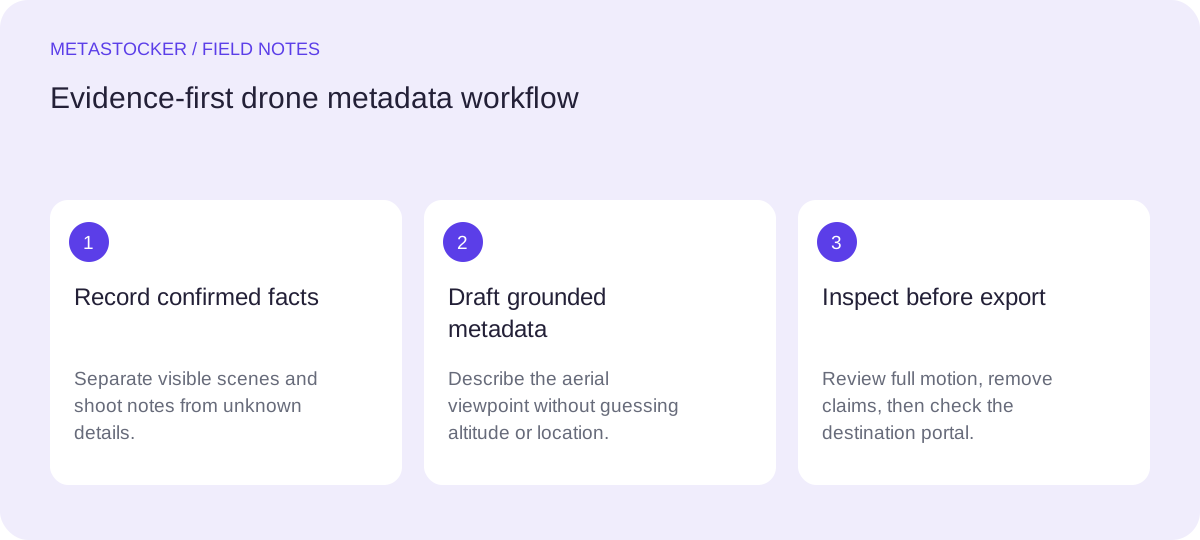
1. Separate visible facts from shoot notes
Watch the full motion before writing metadata. A sampled preview can show the general composition, but it may miss a vehicle, person, sign, change in direction, or other detail that alters the description. First write two short lists: facts visible in the complete clip and facts confirmed by the photographer’s notes.
For this example, visible facts include a river, a rural road, trees, and an elevated moving viewpoint. The notes add the recording date and confirm that the camera was on a drone. Nothing establishes a named location, altitude, property ownership, or professional surveying. Do not convert visual atmosphere into evidence.
- Use “aerial view” when the elevated viewpoint is clear.
- Use the date only when the shoot notes confirm it.
- Do not name a location that the notes do not identify.
- Do not call footage a survey unless that purpose is documented.
Evidence ledger
Visible: river, rural road, tree-lined landscape, forward motion.
Shoot notes: drone viewpoint; recorded 18 September 2026; slow movement along the road.
Not confirmed: town, country, altitude, ownership, tree species, survey purpose.
2. Describe the viewpoint without inventing altitude
Aerial viewpoint is a visual description. Altitude is a measurement or documented flight detail. They are not interchangeable. A clip can clearly be overhead or elevated without supporting “low-altitude,” “high-altitude,” or a number of metres. Likewise, “drone survey” suggests an activity or purpose that may not be present in the footage.
Prefer wording such as “aerial view,” “drone footage,” “elevated perspective,” or “forward-moving view over a river and rural road,” provided each phrase matches the clip and notes. Avoid technical flight claims unless they appear in reliable records supplied for the asset.
- Viewpoint: aerial, elevated, overhead, or forward-facing when supported.
- Measurement: altitude, height, distance, and flight path only when documented.
- Purpose: survey, inspection, mapping, or monitoring only when confirmed.
Safer title: Aerial drone view moving along a rural road beside a river
Unsupported alternatives: High-altitude river survey; 120-metre drone flight over private land
3. Build a sentence-like title
A useful title identifies the main subject and viewpoint in a natural phrase. Put the strongest concepts early, because some marketplaces give particular attention to the first keywords or terms. Do not turn the title into a compressed keyword pile.
For the worked example, “Aerial drone view moving along a rural road beside a river” says what is visible and how it is presented. It does not pretend to know the location or altitude. If the target platform has a character limit, shorten the sentence while preserving the same evidence. Review the current contributor requirements before exporting or submitting.
- Lead with the viewpoint and principal subject.
- Keep the wording descriptive rather than promotional.
- Remove guessed geography, measurements, ownership, and intent.
Title: Aerial drone view moving along a rural road beside a river
Shorter variant: Drone aerial view of a river beside a rural road
4. Choose precise keywords, not plausible guesses
Create keywords from the evidence ledger, then remove near-duplicates and unsupported associations. Relevant terms for this clip may include aerial view, drone footage, river, rural road, trees, landscape, nature, transportation, and forward motion. Whether every broad concept belongs depends on the actual frames and the platform’s rules.
Do not add a country, city, landmark, private property, exact altitude, tree species, “land survey,” or “mapping” simply because those terms might attract searches. A keyword that is plausible but unverified can make the metadata inaccurate. Follow each marketplace’s current language and count rules; for example, Shutterstock’s supplied guidance requires English descriptive metadata, 7 to 50 relevant keywords, and selection of at least one category, while Adobe allows up to 49 and requires the contributor account language.
- Check each keyword against the full clip.
- Use the platform’s required metadata language.
- Treat broad concepts as optional, evidence-based descriptors.
- Avoid repeated, unrelated, or speculative terms.
Possible English keywords: aerial view, drone footage, river, rural road, trees, landscape, nature, transportation, forward motion, countryside
5. Review with local generation carefully
A metadata assistant can help draft alternatives, but it cannot turn an unknown location or altitude into a fact. MetaStocker’s local mode runs vision and thinking models in the visitor’s browser through WebGPU workers. The model is loaded into memory after an explicit download and load action; that is different from a downloaded browser cache. The first local model download needs internet, and browser storage may later be evicted.
For video, the app bases suggestions on sampled previews, so inspect the full motion yourself. Review every editable result and export only rows that are ready. Extra tags supplied to a batch can land in positions such as start, end, or random; check each file for relevance. The requested tag count is a formatting check, not proof of accuracy.
- Give the batch description only facts shared by every file.
- Use one local parallel thread first; test more only if appropriate.
- Delete unsupported location, altitude, survey, or ownership claims.
- Remember that export does not upload, submit, or embed metadata into originals.
Draft instruction: “Describe the visible river, rural road, trees, and forward aerial movement. Use the confirmed date 18 September 2026 only if a date field is appropriate. Do not infer location, altitude, ownership, tree species, or survey purpose.”
6. Verify the final row for its destination
Before delivery, read the title and keywords as if you were checking a caption for someone who never saw the shoot. Does every concrete claim come from the clip or notes? Is the language correct for the contributor account or marketplace? Are editorial date and location requirements relevant to this submission, or are you accidentally applying them to commercial work?
If you use CSV, treat it as a transport format, not a quality certificate. Platform rules differ. Adobe’s current workflow requires the assets to be uploaded before CSV import, exact filenames including extension and case, and inspection of the resulting metadata in the contributor portal. Check the portal and current contributor policies because requirements can change.
- Inspect the full motion and the final rendered row.
- Confirm filename, language, title length, and keyword count; for Shutterstock, select at least one category; for Adobe CSV, treat the category number as optional and verify any category you provide.
- Check the destination portal after any CSV import.
- Keep the original file unchanged and retain your evidence notes.
Before you continue
- I described the aerial viewpoint without claiming an altitude.
- I used only the river, road, trees, movement, and confirmed date from the scenario.
- I excluded guessed location, ownership, species, and survey purpose.
- I checked every keyword against the full video.
- I followed the destination marketplace’s current language and count rules; for Shutterstock, I selected at least one category; for Adobe CSV, I treated the category number as optional and verified any category I provided.
- I reviewed the final metadata in the contributor portal before submission.
Sources and editorial approach
Prepared with AI assistance. Worked examples are illustrative. Automated checks do not replace checking the requirements of your stock platform. How these guides are made.